

Construction surveying is a set of techniques and measurements performed by a land surveyor, primarily used to determine and mark property boundaries and site features, and to accurately position planned construction elements. It ensures precision in project execution, helps control costs, and supports the quality and compliance of constructed works.
Can‑Explore provides construction surveying solutions tailored to the unique challenges of the industrial and mining sectors. With our advanced technologies, we deliver high‑accuracy data for the planning, execution, and management of your projects, meeting the highest standards in the industry.
Construction surveying for your industry sector:
Our surveying services for the industrial and mining sectors:
Quantity calculation – Volumetrics
We provide rigorous monitoring and precise validation of dimensions and payable quantities, ensuring reliable estimates, optimized resource allocation, and minimized risks of overruns and unforeseen issues for more effective cost management. For more information, visit our page on traditional volumetrics or drone‑based volumetrics.
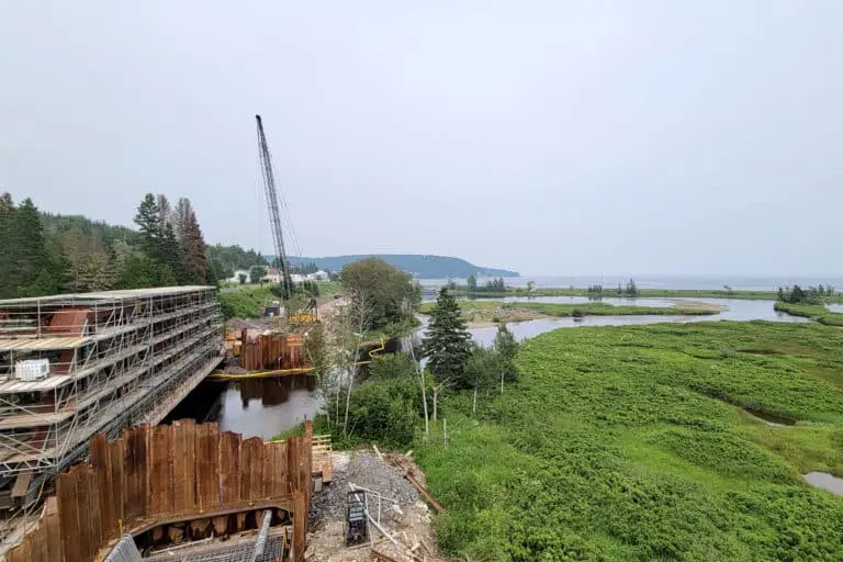
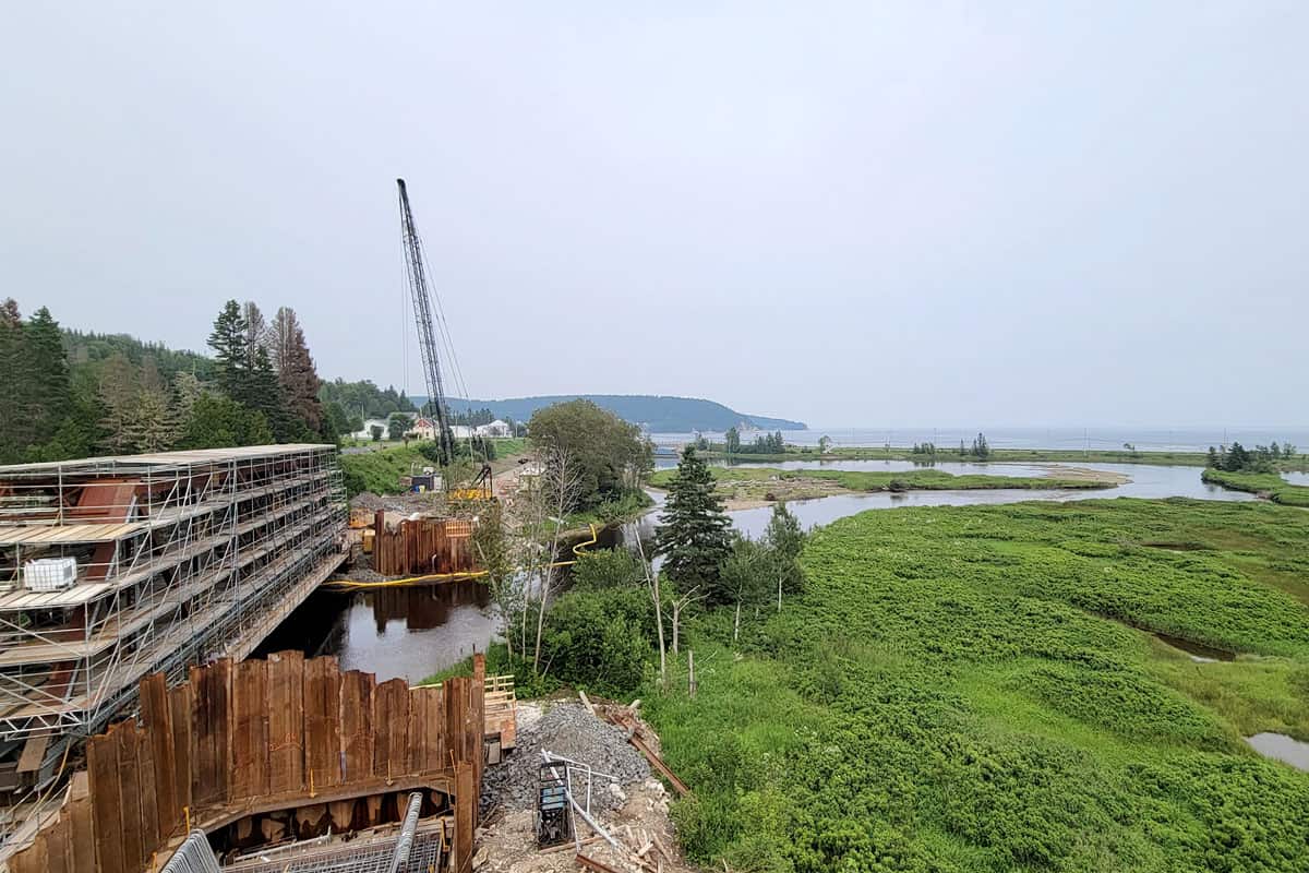
Construction site monitoring
Our periodic surveys make it possible to track site progress, anticipate required adjustments, and ensure compliance with project specifications. For more information, visit our construction site supervision page.
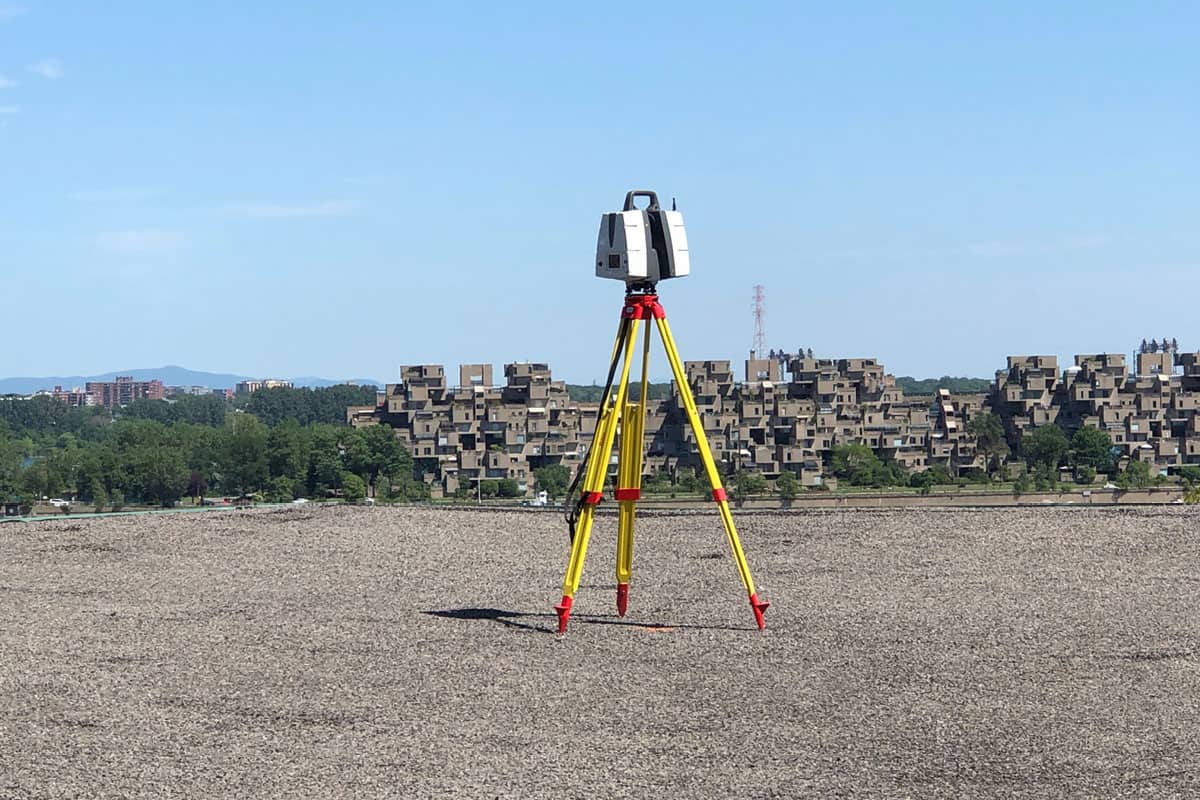
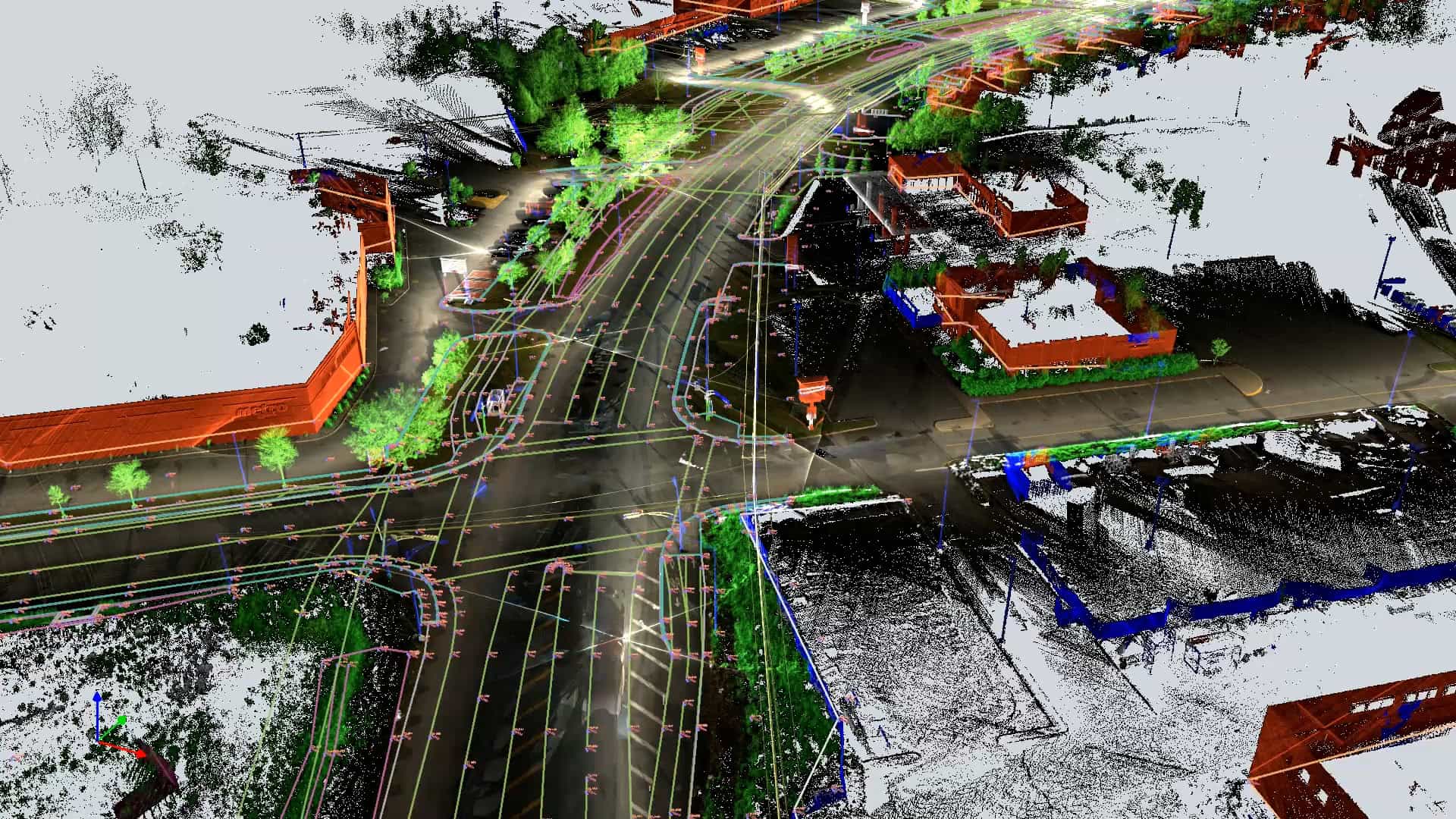
Photogrammetry and 3D scanning
Data collection for accurate three‑dimensional digital modeling of industrial and mining sites and infrastructures. For more information, visit our 3D scanning page or our photogrammetry page.


As‑built plans (TQC)
Updating plans based on actual field conditions, essential for effective management of industrial or mining sites.
Technical drawings and plan preparation
Detailed documentation for effective infrastructure management.
Structure layout – Concrete formwork
Precise positioning for structures. Technical support for positioning concrete formwork.
Planéité et nivellement du sol (FFFL)
Surface leveling control to ensure compliance with tolerance standards, essential for infrastructures requiring optimal flatness.
As-built plans (TQC)
The “as-built” plan (TQC) is a document that represents the final state of a project after completion. It differs from the original plans by reflecting the modifications and adjustments made during construction.
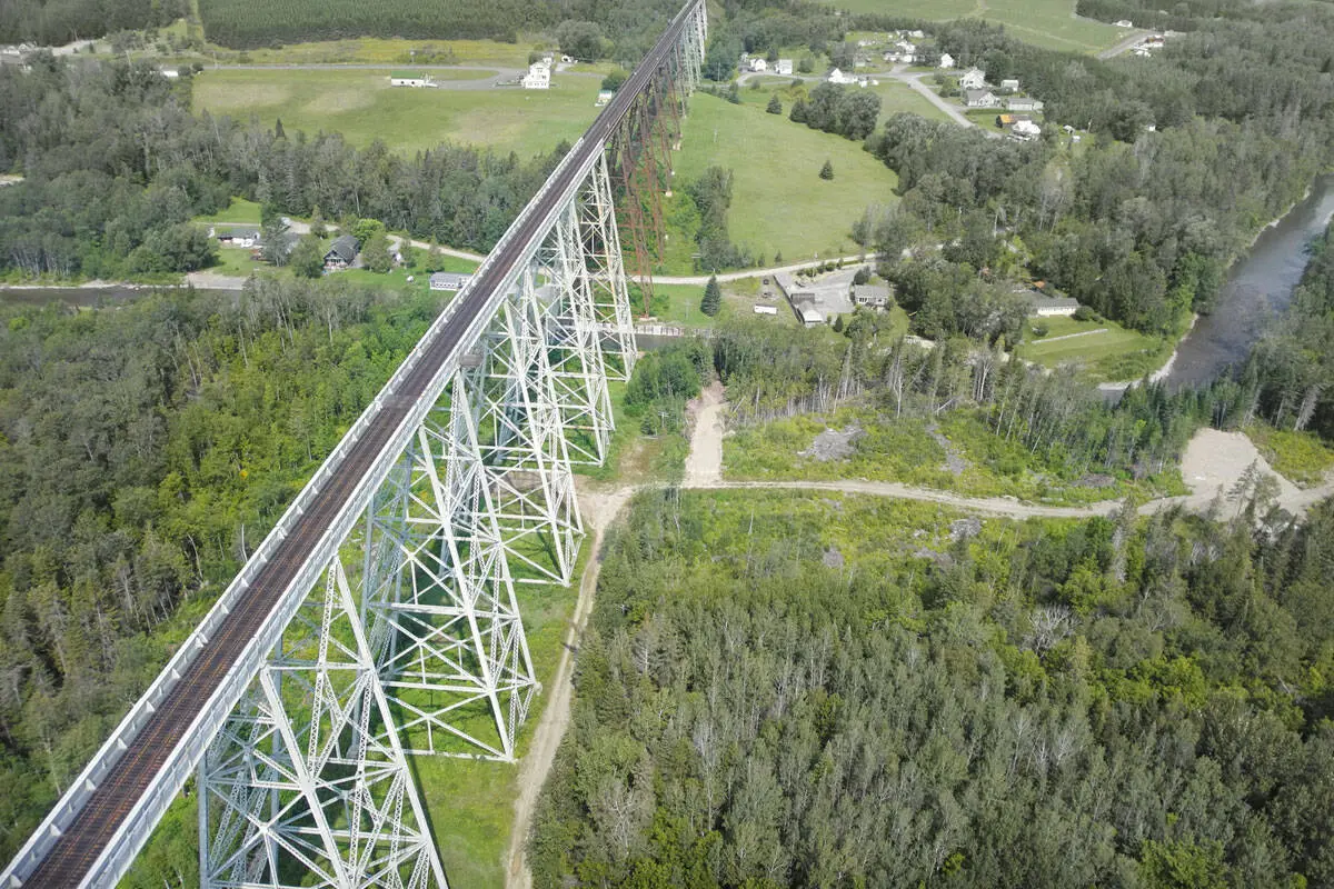
In the transportation and energy sectors, where each project represents a major investment, Can‑Explore uses the most advanced technologies in the field to produce TQC plans with a level of accuracy that meets the highest industry standards. These tools allow us to map large infrastructures with speed and reliability, ensuring compliance and long-term durability. Our expertise provides our clients and partners with a solid foundation to meet the challenges of large-scale projects.
Our specialized surveying tools:
WingtraOne GEN II from Wingtra
The WingtraOne GEN II is an advanced, intelligent mapping drone that delivers unmatched performance for surveying large sites (photogrammetry). This drone maximizes coverage in a single flight, capable of covering up to 460 hectares in one hour, optimizing surveying operations by reducing labor hours. With its VTOL design (vertical takeoff and landing), it performs exceptionally well on vegetation‑free terrain. The WingtraOne GEN II is equipped with a 61 MP camera, providing the highest‑quality imagery with an absolute horizontal accuracy of less than one centimeter.
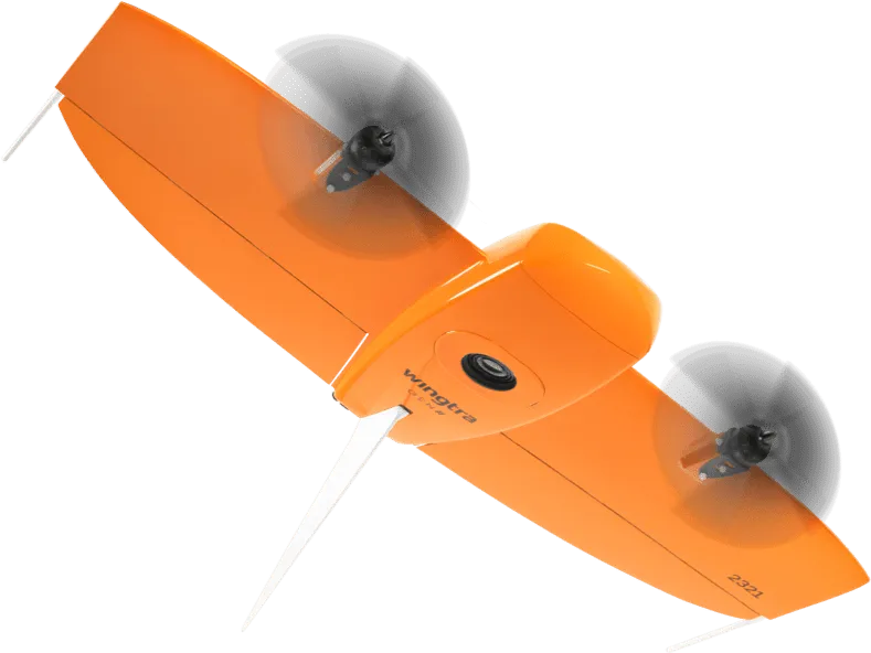
Image from Wingtra.
Leica Pegasus TRK 700 Neo
The Leica Pegasus TRK 700 Neo is a state‑of‑the‑art mobile mapping tool capable of capturing more than one million LiDAR points per second. Powered by artificial intelligence, it is the ideal solution for rapid surveying of long roadway segments. With integrated SLAM (Simultaneous Localization and Mapping) and high‑precision RTK (Real Time Kinematics) positioning, this system georeferences geospatial data with centimeter‑level accuracy. Its built‑in cameras with ISOFIX finally allow RGB photo colorization to be applied to the point clouds collected by its LiDAR scanner.
Image from Leica Geosystems.
NavVis MLX from NavVis
The NavVis MLX transforms 3D reality capture with its advanced, portable technology. Its compact and ergonomic design offers unmatched mobility for surveyors, making it ideal for quickly and efficiently scanning the interior of a building or structure. With its 32‑layer LiDAR sensor combined with SLAM (Simultaneous Localization and Mapping) software, this system delivers the highest point‑cloud quality among comparable tools. Finally, its four integrated cameras capture high‑resolution 360º images, enabling RGB photo colorization to be applied to the point clouds collected by its LiDAR scanner.
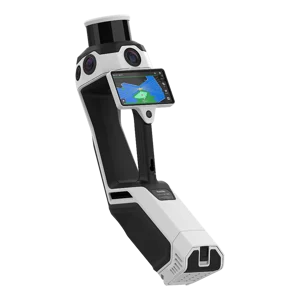
Image from NavVis.
Ask for a Quote – Construction surveying for industrial and mining sectors
Any questions? A specific project in mind?
Don’t hesitate to contact us. Our solutions are tailored to your needs.