

Certificate of Location
Legal Survey – Residential
Your projects deserve the best reference points!
Choosing Can-Explore for your certificate of location ensures you a rigorous, reliable, and human-centered service.
Recognized Expertise in Surveying
Our land surveyors have extensive experience in the real estate and residential sectors. Their multidisciplinary expertise enables them to identify all the issues.
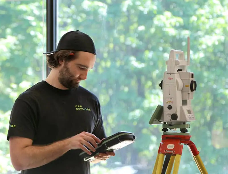
Rigorous Approach and Accurate Data
We use state-of-the-art equipment and to guarantee reliable data. Our meticulous field approach ensures the accuracy of our observations.
Personalized Service and Expert Advice
Each property is unique, so we tailor our analysis to your specific situation. Our experts clearly explain the results of their analyses and advise you on any necessary actions.
Please note that we produce certificates of location for the regions of Québec, Chaudière-Appalaches, and Portneuf.
A certificate of location is a legal document prepared by a land surveyor that includes a plan and a report detailing the main features of a property or land. It serves as essential protection for both the buyer and seller during a real estate transaction, and ensures compliance during construction work. In other words, the certificate of location is like an official health check of a property at a specific moment in time.
Can-Explore offers legal surveying services to produce certificates of location, conducted by our surveying professionals who are members of the Ordre des arpenteurs-géomètres du Québec (OAGQ).
What does the certificate of location contain?
The certificate of location includes a comprehensive analysis that includes:
The Report
- Description of the physical state of the property;
- Cadastral information (updated lot numbers following a cadastral renovation, for example);
- Identification of encroachments and servitudes (rights of way, view rights, etc.);
- Analysis of specific burdens (presence of electrical wires, pipelines, etc.);
- Verification of municipal compliance (flood zones, waterfront areas, etc.);
- Compliance with Quebec legislative provisions (Civil Code of Quebec, environmental laws, built heritage, etc.);
- Impact of cadastral renovations and regulatory changes;
- Any other relevant information depending on the situation.
The Technical Plan
- Exact shape, dimensions, and area of the land and buildings;
- Positioning of all occupancy elements (fences, hedges, pools, sheds, heat pumps, etc.).

How long is my certificate of location valid?
Although no specific law sets an expiration date for a certificate of location, it is considered “out of date” or “expired” when it no longer reflects the current and actual situation of the property. Thus, a certificate over 10 years old usually requires an update, especially if modifications have been made to the property or the regulations.
Criteria that invalidate an old certificate of location
Here is a brief checklist of criteria that require the production of a new certificate of location.
| Criteria | Description | Impact on validity |
|---|---|---|
| Physical changes to the property | Addition or removal of buildings, pool, fence, expansion, etc. | The old certificate no longer reflects the current state of the property, so a new certificate is needed. |
| Cadastral Operation | Land division resulting in new lot numbers. | A new certificate is required if the old one predates the operation. |
| Regulatory Changes | Changes in municipal bylaws or laws (flood zones, etc.) | A certificate compliant with the new standards is required. |
| Servitudes | Creation, modification, or removal of servitudes. | A new certificate is necessary to document these changes. |
| Stakeholder Requirements | Requirements from a notary, lender, or broker (recent certificate). | A new certificate may be required even without other changes. |
When do you need a certificate of location?
The certificate of location is required during:
- Sale or purchase of a property (residential, commercial, vacant land, condos, etc.);
- Mortgage application;
- Real estate refinancing.
Who must provide the certificate and who bears the costs?
In Quebec, the seller is legally required to provide the buyer with a copy of the certificate of location they possess. This document must, of course, reflect the current state of the property, as mandated by Article 1719 of the Civil Code of Quebec.
However, there’s an important nuance: if the buyer requests a new certificate and it reveals no modifications or changes compared to the document already provided (and paid for) by the seller, the costs of this new certificate may then fall to the buyer. Specific arrangements regarding costs can sometimes be negotiated between the parties.
Costs and production timelines
The price suggested by the Ordre des arpenteurs-géomètres du Québec for a single-family home in an urban area is around $1580 (excluding taxes and disbursements). Additional fees—typically starting from $200—are expected for obtaining copies. The final cost may vary depending on several factors, such as the complexity of the file or the land, specific skills required, etc.
Regarding production timelines, the typical time to obtain a new certificate of location is generally between 4 and 6 weeks. This timeframe includes the time needed for field measurements, data analysis, and report writing. It’s crucial to anticipate these timelines, as the notary requires the certificate at least 20 days before the signing of a deed of sale.
Need expedited service?
Contact our team to learn more about our priority processing options in less than 4 weeks.
Certificate of location for condominium
Can-Explore also produces certificates of location for the private portions of condominium buildings (vertical cadastre). Our land surveyors ensure they consult the declaration of co-ownership (which includes the cadastral plan of private and common areas) and the building’s regulations. We conduct a visit of the unit and its surroundings to establish this document.
FAQ – Other frequently asked questions about the certificate of location
Our land surveyors have compiled other frequently asked questions about the certificate of location. Feel free to contact us with any additional questions!
Are physical markers (stakes) installed during a certificate of location?
No, physically identifying boundaries is not part of the purpose or scope of a certificate of location. This requires a separate process, which can sometimes be done concurrently, called a staking certificate.
Do I need to obtain a certificate of location to sell my condo?
Yes, a certificate of location can apply to the private portion of a condominium building, such as a condo (vertical cadastre). It offers the same guarantees and is governed by the same regulations as for a horizontal property. This document pertains only to the condominium being sold; the land surveyor does not study the entire condominium complex.
What should I do if I have lost my certificate of location?
If you have lost your certificate of location, the only person authorized to issue a certified copy of this document is the land surveyor who produced it, or the custodian of their records if they have ceased practicing.
Is it possible to conduct surveying in winter?
Yes, absolutely! We can achieve our objectives despite more challenging conditions. However, some elements might not be illustrated in our plans if snow or ice make them invisible during the surveys.
What is the Quebec Cadastre?
The cadastre is like a very large official map of all of Quebec. On this map, land surveyors have drawn each plot and property. Essentially, the cadastre is a public register (like a big book or database) that contains all these detailed maps. Its main purpose is to precisely position the boundaries of each lot, uniquely identify them (cadastral lot number), and describe them (area, nature, etc.), so no one accidentally steps onto their neighbor’s property!
What is the cadastral renewal?
The cadastral renewal is a major operation initiated by the Quebec government in 1994. Its goal is to consolidate all the old cadastres, which were previously divided into parishes, townships, or seigneuries, into a single unified cadastre. This monumental task modernizes and harmonizes the official identification and delineation of all land in Quebec.
What is legal surveying?
It’s a term used to describe activities reserved for the surveying profession, as prescribed by Article 34 of the Land Surveyors Act. Essentially, the land surveyor is the only professional authorized to position property boundaries and land rights. They are also the only ones who can prepare and modify a plan for the Quebec Cadastre.
What is a minor exemption?
A minor exemption (or minor variance) is like a special permission that the municipality can grant. It can be a solution to address a non-compliant element identified in a certificate of location. A land surveyor can prepare or assist the owner in preparing a minor variance application.
What is an acquired right?
In the practice of a land surveyor, the term “acquired right” is often used to describe a non-conforming situation that predates the municipal regulation prohibiting it. A land surveyor cannot determine the existence of an acquired right, unlike a legal expert.
Can I build a residence within an agricultural zone?
No, residential use and subdivision within an agricultural zone are prohibited. However, certain exceptions are outlined in the Act Respecting the Preservation of Agricultural Land and Agricultural Activities. A land surveyor can prepare a request for verification of a right or an application for authorization with the CPTAQ.