

Can-Explore offers specialized expertise in legal surveying tailored to meet the unique challenges faced by municipalities in land management and development. Our services, delivered by qualified land surveyors, are crucial for ensuring regulatory compliance, minimizing land dispute risks, and fostering sustainable urban planning.
Whether you are preparing land development, construction, or municipal land sale projects, our expertise and advanced technologies are invaluable tools for making informed decisions. They enable you to secure investments, optimize infrastructure management, and plan urban projects while safeguarding public interests.
Acts performed in legal surveying are reserved for the profession of land surveyor. They are provided for in Article 34 of the Land Surveyors Act.
Legal surveying for your industry:
Services for the municipal sector:
Technical Description
Technical descriptions are written documents that precisely define the boundaries, features, and characteristics of a property or parcel of land. These are essential for notarial deeds, land subdivision, or assessing a project’s compliance with urban planning regulations. For excavation, construction, or public service installation projects, this tool ensures transparency and legal security in all land-related transactions and projects.
Property Line Survey Certificate (Staking Certificate)
This technical document, prepared by a land surveyor, physically marks the boundaries of a property using visible markers (e.g., stakes, iron rods). It minimizes the risk of land disputes with adjacent property owners and is often required for obtaining building permits.
Legal Boundary Survey (Bounding)
An official process to definitively establish the boundaries of a property when they are contested or uncertain. This procedure, governed by Quebec’s Civil Code, is conducted under the authority of a land surveyor.
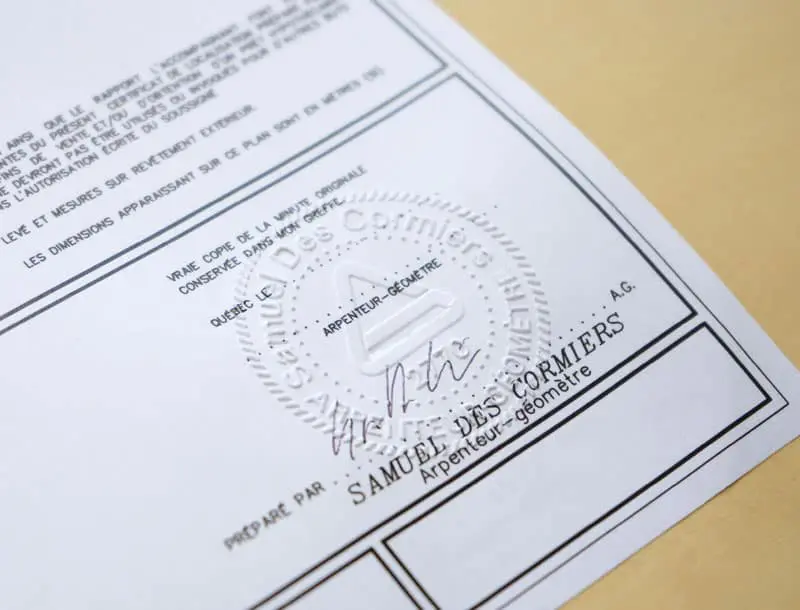
Certificate of Location
A legal and official document prepared by a land surveyor that outlines the current and legal status of a property, including easements. It provides a detailed plan and report of the boundaries of existing municipal properties. It is required for property sales (to be provided to the notary), compliance confirmation before construction or renovation projects, and resolving land disputes.
Topographic and Elevation Surveys
These surveys provide information about the terrain’s characteristics, including flood zones, wooded areas, relief, and water courses. They supply essential data for understanding and working with a property effectively.
Cadastral Operations and Subdivision
A process to modify or create the official representation of a property in the cadastral registry, the public land registry of a given territory. Conducted by a land surveyor, this process involves preparing plans and official documents to be filed with the relevant authorities (in Quebec, the Land Registry of Quebec).
Implementation Certificate
A document certifying the precise location of a building or structure in relation to property boundaries. The implementation certificate materializes these elements on-site and may be required by municipalities before issuing building permits. It ensures municipal construction projects comply with property boundaries and local urban planning regulations.
When Might You Need a Land Surveyor?
Updating Location Certificates for Public Infrastructure
Verify the legal status of buildings such as town halls, schools, or libraries for transactions, refinancing, or evaluations.
Planning Major Municipal Developments
Whether developing industrial zones, creating parks, or establishing new residential streets, we prepare detailed plans and topographic analyses to guide your projects.
Assessing Flood Zone Presence
Our analyses confirm if municipal land or future projects are located in at-risk zones, enabling the planning of appropriate measures.
Selling or Subdividing Municipal Land
If you wish to divide a large parcel to host community projects or sell it in smaller plots, we create new cadastral lots and provide the required legal documents.
Creating or Adjusting Easements
To facilitate access to public infrastructure such as bike paths, green corridors, or rural roads, we accurately determine and document the necessary easements.
Resolving Land Disputes
When disputes arise regarding the boundaries of municipal land and adjacent properties, our boundary determination plans clarify the limits for fair and lasting resolution.
Municipal Property Appraisal and Refinancing
We provide detailed geometric documents to support your property evaluation or refinancing processes.
Expanding Green Spaces or Recreational Areas
For planning new parks, playgrounds, or green spaces, our surveys ensure every step complies with standards and community needs.
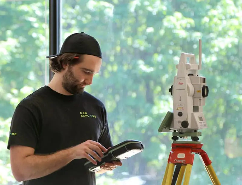
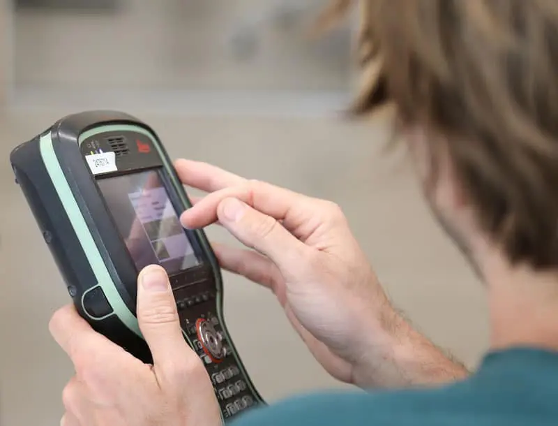
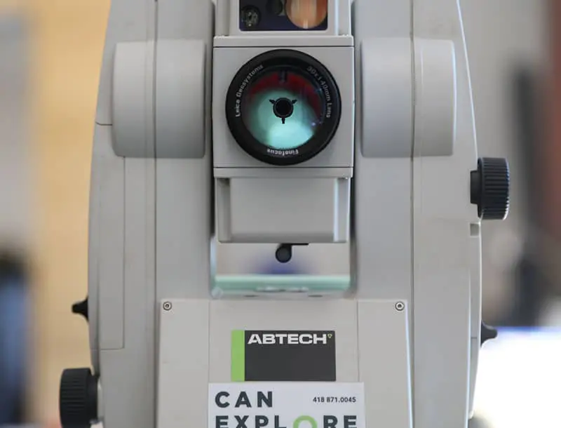
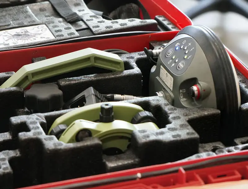
State-of-the-art tools at your service
The versatility of the land surveyor is made possible by their mastery of various technological tools, allowing them to be more precise, faster, and ultimately more efficient:
- GNSS positioning devices, which calculate positions anywhere on the Earth’s surface.
- Total stations, which measure both angles and distances.
- LIDAR laser scanners, which capture billions of measurements in a three-dimensional environment.
- Drones, which provide high-definition aerial imagery.
Our specialized surveying tools
WingtraOne GEN II by Wingtra
The WingtraOne GEN II is a cutting-edge, intelligent mapping drone that offers unparalleled performance for surveying large sites (photogrammetry). This drone maximizes coverage in a single flight, covering up to 460 hectares in one hour, optimizing surveying operations by minimizing labor hours. With its VTOL (vertical takeoff and landing) design, it excels particularly on vegetation-free terrain. The WingtraOne GEN II is equipped with a 61 MP camera, ensuring the highest quality images with an absolute horizontal accuracy of less than one centimeter. Its advanced GNSS PPK technology ultimately eliminates the need for ground control points, further reducing on-site preparation time.
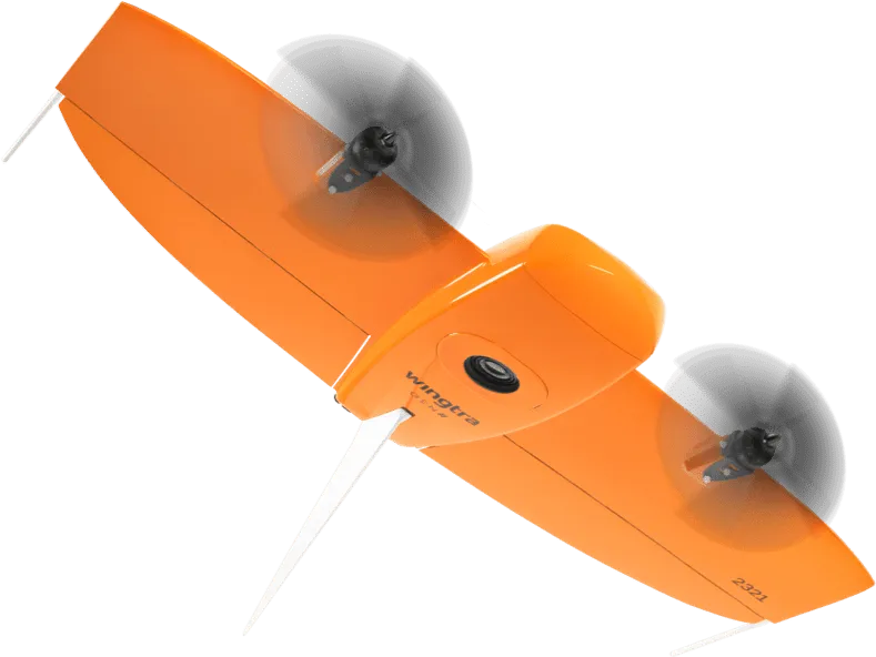
Image courtesy of Wingtra.
Pegasus TRK 700 Neo by Leica
The Pegasus TRK 700 Neo by Leica is a cutting-edge mobile mapping tool capable of capturing over one million LiDAR scans per second. Equipped with artificial intelligence, it is the ideal tool for quickly surveying long road segments. By integrating SLAM (Simultaneous Localization and Mapping) and RTK (Real Time Kinematics) positioning precision, this device references geospatial data with centimeter-level accuracy. Its integrated ISOFIX cameras capture ultra-high-resolution images, enabling detailed 3D visualization of point clouds collected by its LiDAR scanner.
Image courtesy of Leica Geosystems.
NavVis MLX by NavVis
The NavVis MLX revolutionizes 3D reality capture with its advanced handheld technology. Its compact and ergonomic design provides unlimited mobility for surveyors, making it perfect for scanning confined, complex, and hard-to-reach spaces. Featuring a 32-layer LiDAR sensor paired with SLAM (Simultaneous Localization and Mapping) software, this system ensures the highest point cloud quality among comparable tools. Additionally, its four integrated cameras capture high-resolution 360º images, enabling exceptional 3D visualization of the collected data.
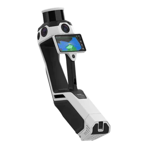
Image courtesy of NavVis.
Request a quote: Land surveyor services
Any questions?
Don’t hesitate to contact us. Our solutions are tailored to your needs.