

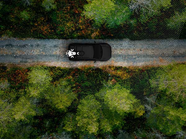
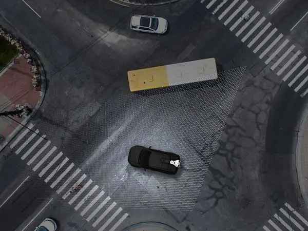
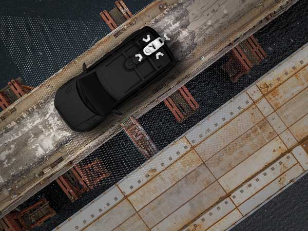
Mobile mapping is a method of acquiring geospatial data from a moving vehicle on road, rail, or even maritime routes. It represents an advancement in the field, offering unprecedented surveying accuracy thanks to the use of LiDAR technology fixed to a vehicle. Unlike traditional methods, mobile mapping makes it possible to acquire data with increased efficiency and speed, all while avoiding disruptions to activities, such as road closures. Additionally, it adds a safety element by allowing surveyors to conduct scans without being on the edge of roads where other vehicles are traveling.
Why Choose Can-Explore for Mobile Mapping?
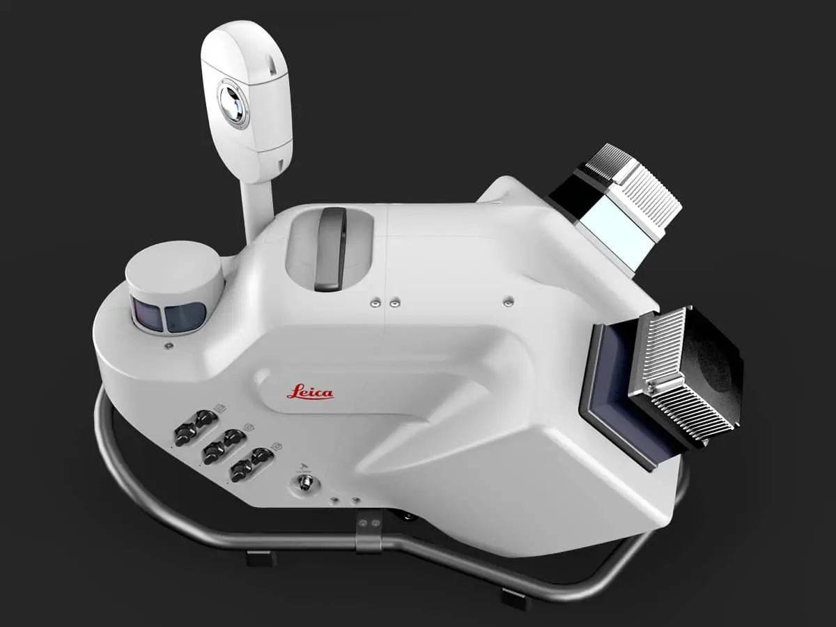
At Can-Explore, we have established a mobile mapping service to provide our clients with a unique and innovative mapping solution. Can-Explore has one of the newest mobile scanning systems on the market, the Leica Pegasus TRK 700 Neo. We are the first in Quebec to possess this system. Our equipment enables us to collect data with unmatched precision compared to other technologies.
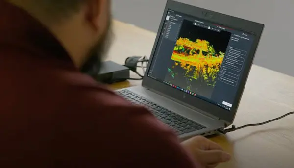
We also rely on our own team of certified surveyors and geomatics technicians to ensure the quality of our services. Our surveyors are able to certify the point clouds produced by the scans.
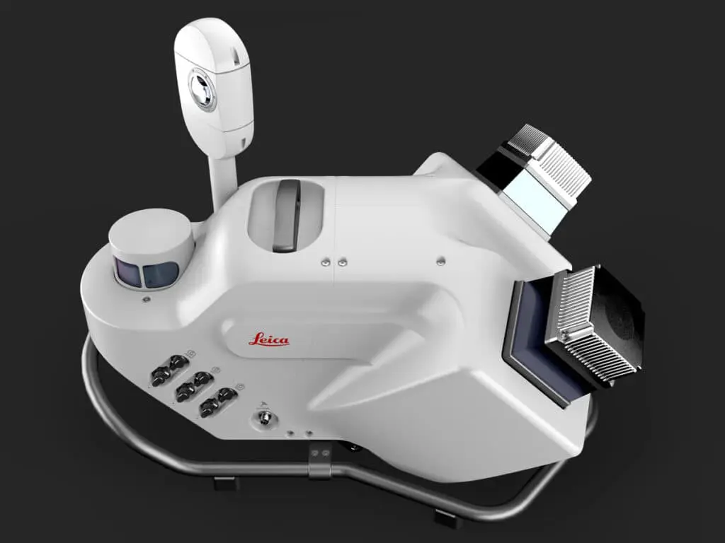

Images: courtesy of Leica Geosystems.
Applications of Mobile Mapping
Mobile mapping applies when data collection is required over a significant distance. The LiDAR scan is attached to a vehicle traveling at speeds of up to 100 km/h, allowing data to be captured over several kilometers. With traditional methods, the process could take months, whereas it will take just a few hours with mobile mapping.
Mobile mapping is therefore applicable in many varied sectors that require data collection over a significant distance, including:

Construction and Infrastructure
Road planning, railways, as-built plans, bridges, tunnels, etc.
Municipal
Urban planning and development: 3D modeling, urban planning, network management, as-built plans, inventory mapping, etc.
Natural Resource Management
Environmental studies, monitoring sensitive areas, etc.
Telecommunications and Energy
Electrical network planning, management, or construction of wind farm parks or paths.
The Mobile Mapping Process
The mobile mapping process consists of several steps:
Step 1
Marking control points and tracing targets to have fixed elements that will position the point cloud on precise coordinates. This step is optional if absolute precision is not required.
Step 2
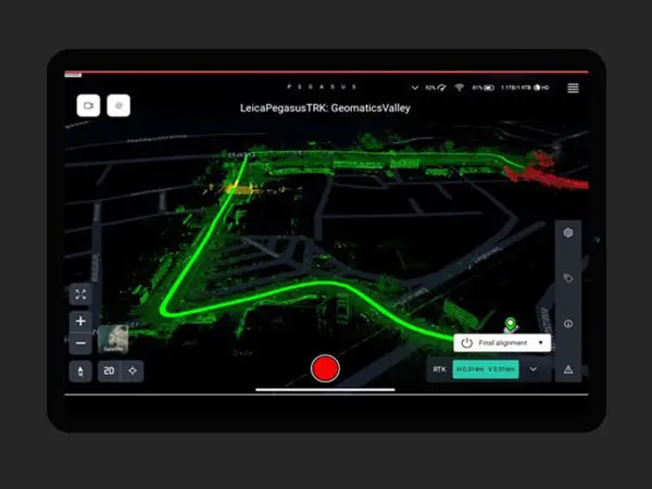
Data collection while driving with the vehicle equipped with the scanner.
Step 3
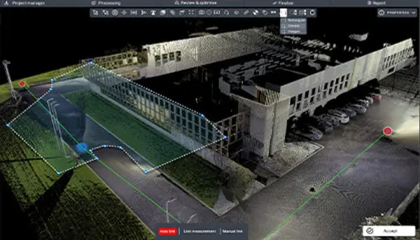
Processing the point cloud.
Step 4
Delivery of the result to the client. The deliverable varies depending on what the client desires. It can be the geolocated point cloud, an AutoCAD plan, access to a platform for viewing, or simply raw data that can then be processed by the client.
Request a Demo or Quote for Your Mobile Mapping Project
We are here to meet your mobile mapping needs. Our services are available throughout Eastern Canada. Contact us now to schedule a free demonstration or request a personalized quote for your project.
Any questions? A specific project in mind?
Don’t hesitate to contact us. Our solutions are tailored to your needs.